One of the simple but often overlooked aspects of survey and planning is the use of the Dumpy Level. Locate a benchmark, set up the dumpy level, create a Temporary Bench Mark and record readings which are reduced to absolute heights, based on the National Grid System. Using a Diff GPS will of course remove the need for this, but understand how to carry out this activity helps in many ways, including having a fall-back device, how heights are worked out and even allow you to create horizontal section lines with ease.

PRINCIPLE: Understand the concept behind level heights along with the setting out and collection of data for the purpose of survey.
- Novice – Can take levels and read bearings on the level, but needs help in setting up and checks on staff reading.
- Competent – Is able to set up a dumpy level as well as take levels and bearings, but requires reminding and checking of figures.
- Proficient – Will understand the principal to a level where they can set up the level, take the correct measurements and readings that are required for both Bearing and distance as well as standard levelling.
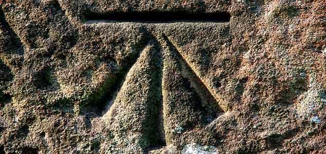
The Ordnance Survey benchmark symbol | Image credit: Chalto/Flickr.
Professional tips:
Always check the initial calculations 3 times and write them in a levels book or on the plan or section.
Look on the 19th century OS maps for bench marks – they are less likely to appear on modern maps – and the reading is in decimal feet.
Check the Bench Mark has not been moved. There are approximately 500 000 ‘lower order’ BMs still remaining. This number is reducing due to property development, road widening and so on. The BM heights shown have not been maintained for 30 years and should not be relied upon to accurately define ODN.
Take your time and use a calculator, there is no prize for speed. only accuracy.
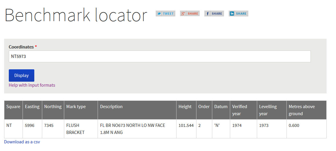
Use the Bench Mark Database to locate a nearby bench mark and coordinates , and enter into the OS BenchMark Finder (XX9999 format) to derive a height
For example, enter NT5973 as the coordinate and the result is